



| IN A NUTSHELL |
|
The advancement of technology continues to reshape our understanding of the world, offering innovative tools that promise to revolutionize fields like environmental science and national security. One such breakthrough is the HALE InSAR, a compact radar system developed through a collaboration between NASA and the aerospace company Aloft Sensing. This lightweight and energy-efficient instrument promises to transform our ability to monitor Earth’s surface with unprecedented precision. Utilizing advanced algorithms, HALE InSAR operates without GPS and can detect minute changes in terrain and vegetation. Its potential applications range from early disaster warnings to enhancing scientific research across the globe.
Innovative Radar Technology
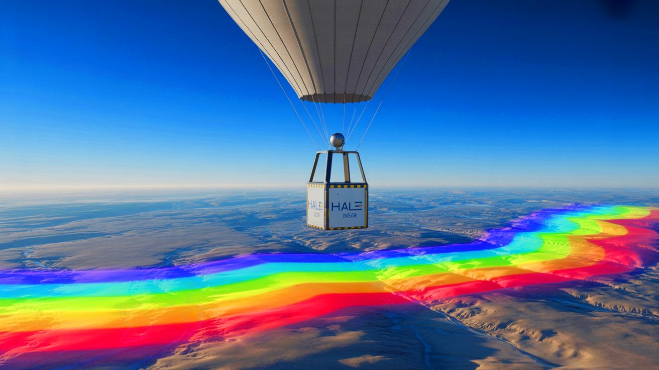
HALE InSAR, short for High-Altitude, Long-Endurance Interferometric Synthetic Aperture Radar, represents a significant leap in radar technology. Unlike traditional radar systems, which are often bulky and resource-intensive, this radar is designed to be both compact and efficient. Weighing less than 15 pounds and consuming only 300 watts of power, it operates with the energy equivalent to a small electric bike. This allows it to be mounted on HALE platforms, aircraft capable of remaining airborne for extended periods.
What truly sets HALE InSAR apart is its ability to function without relying on GPS. Instead, it uses sophisticated positioning algorithms that provide high accuracy, even in the absence of satellite navigation. This makes it particularly valuable for operations in remote or GPS-denied environments. According to Brian Pollard, Chief Engineer at Aloft Sensing, the system’s ability to avoid “image smearing” is akin to using a long-exposure camera with radio waves. This capability is crucial for capturing clear and precise data.
Shocking CIA Move: “Reviving Giants” With $30M Tech Plan Raises Ethical Firestorm Across America
Potential Applications and Benefits
One of the most promising aspects of HALE InSAR is its ability to monitor geological changes with millimeter precision. This sensitivity allows for early detection of natural disasters such as volcanic eruptions, landslides, and other geophysical events. By providing timely warnings, the system could significantly mitigate the impact of such disasters, potentially saving lives and reducing economic losses.
In addition to disaster prevention, HALE InSAR’s applications extend to national security and scientific research. Its ability to operate in remote areas without GPS makes it an invaluable tool for surveillance and reconnaissance missions. Similarly, scientists can leverage its precision to study Earth’s dynamic systems, such as glacial movements and tectonic shifts, with greater accuracy than ever before. Lauren Wye, CEO of Aloft Sensing, emphasizes the instrument’s potential, stating that it offers a level of sensitivity that was previously unattainable without increasing size or cost.
Scientists Claim “Universe’s First Molecule” Recreated in Lab Sparks Outrage Among Skeptics
From Stratosphere to Space
The development of HALE InSAR has been a journey from concept to proven technology. Initially validated on airships and stratospheric balloons at altitudes of 65,000 feet, the system has demonstrated its capabilities in challenging environments. The next phase involves testing on fixed-wing HALE aircraft, with the potential for future deployment on small satellites in low Earth orbit. This progression opens up new possibilities for monitoring Earth’s surface from space.
Supported by NASA’s Earth Science Technology Office, the project exemplifies the successful collaboration between a government agency and a private company. This partnership has allowed Aloft Sensing to transform a prototype into a commercially viable product that has garnered interest from both civil and military sectors. The ability to merge high-altitude endurance with GPS-independent positioning and millimeter-scale precision marks HALE InSAR as a game-changer in the field of Earth observation.
Looking Ahead
As HALE InSAR continues to evolve, its impact on environmental science and security is expected to grow. The instrument’s ability to provide real-time data with exceptional accuracy can revolutionize how researchers and agencies monitor Earth’s dynamic systems. Its compact size and GPS-free operation make it adaptable to a wide range of platforms, from balloons and aircraft to potential satellite deployment.
The success of HALE InSAR raises important questions about the future of remote sensing technology. As we continue to explore the potential applications of such innovative tools, one might wonder: How will advancements in radar technology further enhance our ability to understand and protect our planet? The possibilities are vast, and the answers may redefine the boundaries of scientific discovery and security measures in the years to come.