

Isaias leaves two dead as it fades over the US south-east
Falling trees killed two people in Florida and Alabama, and forecasters still warn of floods, landslides and tornadoes as the weakened storm pushes inland.
 By
Ellis Marwood
By
Ellis Marwood
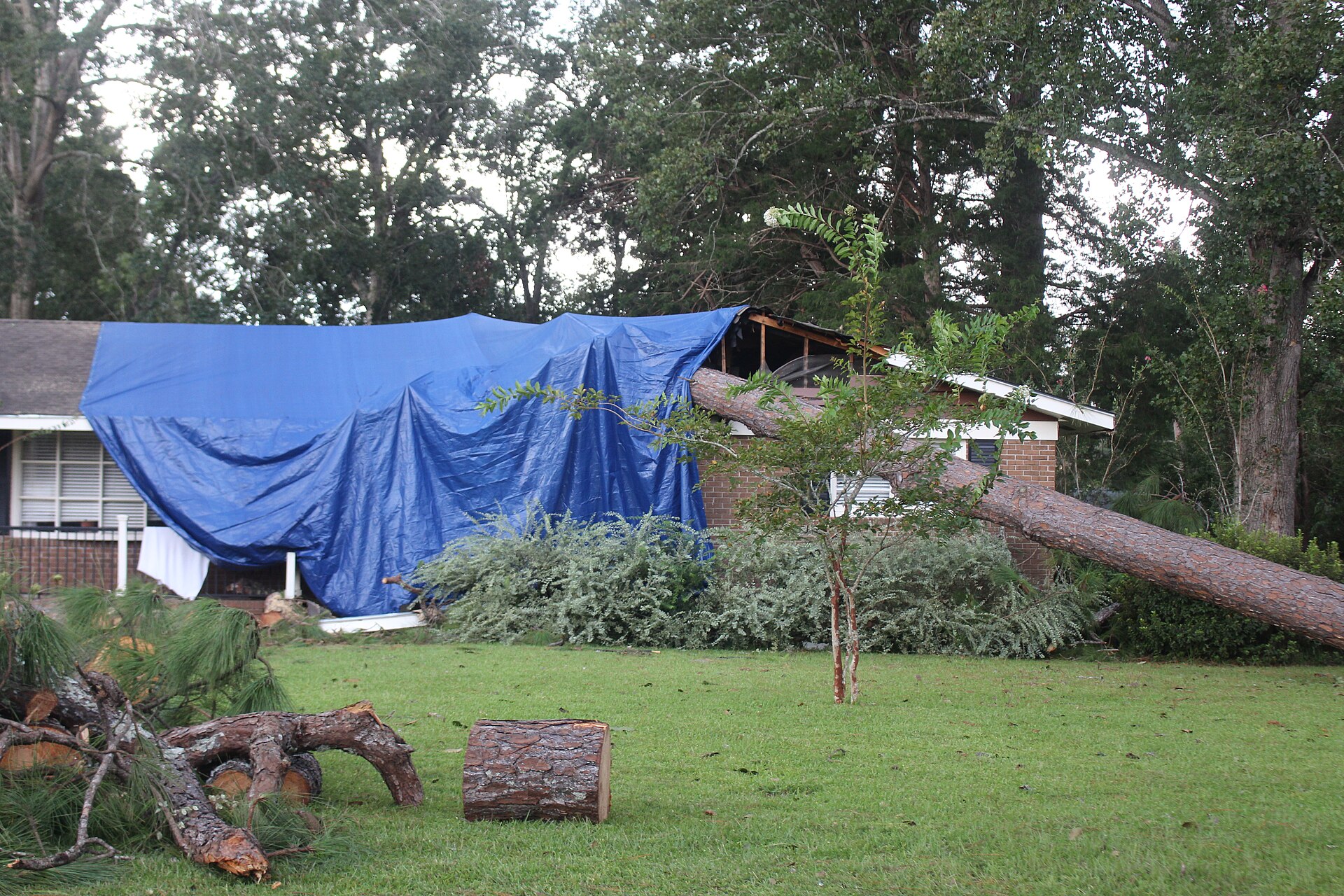
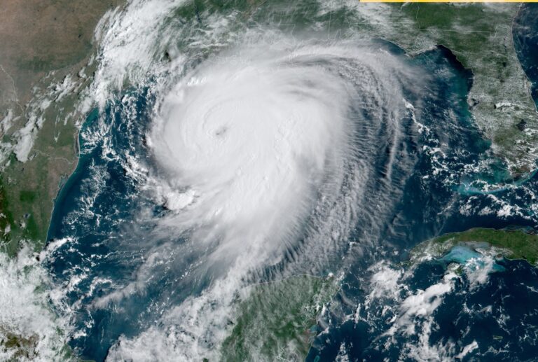
Two people have died after Isaias struck Florida’s panhandle late on Friday, and the storm, now a post-tropical cyclone, still threatens floods and tornadoes inland.
In brief
- Isaias came ashore near Destin, Florida, late on Friday as a category 2 hurricane.
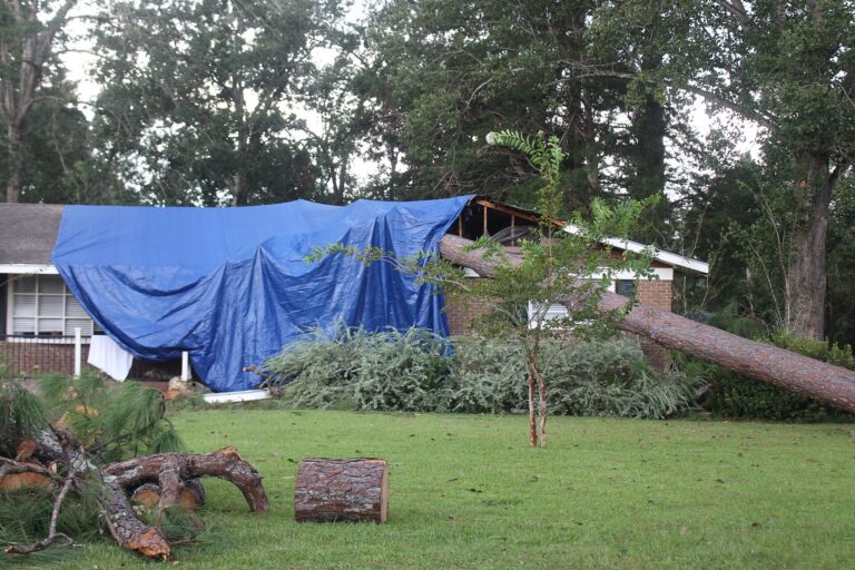
- Trees falling on homes caused deaths in Escambia county, Florida, and Birmingham, Alabama.
- By Saturday the storm was post-tropical, but flash flooding and tornadoes remained possible.
- Isaias ties a 1905 record as one of the two latest-forming first Atlantic hurricanes.
Falling trees and a darkened region
Both deaths happened when trees came down on houses, local officials said: one in Escambia county, Florida, the other in Birmingham, Alabama, as the system tracked inland. Isaias had come ashore near Destin, a landfall covered in our report on Isaias reaching Destin, and forecasters expected it to dissipate on Sunday.
The outage count, compiled by PowerOutage.us, covered Florida, Alabama and Georgia as residents started clearing up. In Pensacola, Tim Mowry lost electricity on Friday afternoon but had a generator to fall back on. His son, trying to reach him, was forced to turn round because fallen trees and cables had closed the road.
In Crestview, Florida, Ashley Weeks told the local station WEAR that a tree from her own garden crashed onto the house, wrecking part of the roof close to her daughter’s bedroom. It was, she said, “just scary, everything, my whole life is in the house”.
Florida governor Ron DeSantis told Fox News on Saturday morning that his administration had not yet received reports of any deaths in the state, crediting what he saw as stronger preparation and experience. “We’re a peninsula in the middle of a tropical part of the world,” he said.
Why a weaker storm is still dangerous
Storm surge and tropical storm warnings have been lifted. Even so, the National Hurricane Center expects “considerable impacts” over much of southern Alabama, the Florida panhandle and south-western Georgia. Its Saturday-morning advisory flagged possible flash, urban and river flooding across the region, and a considerable risk of flash floods and landslides in the southern Appalachians.

Tornadoes are the other concern. The NHC said that risk would last through Saturday afternoon over parts of the eastern Florida panhandle, Georgia and the Carolinas.
“Right now, we are worried about strong winds, heavy rain and possible spinoff tornadoes in certain parts of the state”
Kay Ivey, Alabama’s governor
Ivey urged Alabamians to prepare for the worst and to make sure they have dependable information before setting off on any weekend journeys.
How much rain to expect by Sunday
Forecast totals, as reported by The Guardian, vary sharply by area:
| Area | Expected rainfall | Localised maximum |
|---|---|---|
| Southern Alabama, Florida panhandle and Big Bend, south-west Georgia | 4-8in | Up to 15in |
| Much of the rest of the south-east US | 2-5in | Up to 10in, especially southern Appalachians and coastal Carolinas |
A late hurricane in a quiet season
Isaias was the season’s first Atlantic hurricane. None of the eight named storms before it grew beyond tropical storm strength. Only one other season has waited as long for its first hurricane: 1905, when the first one also formed on 8 October. The next latest dates were 11 September, in both 2002 and 2013.
The quiet run was broadly anticipated. At the start of the season, Noaa forecast three to six hurricanes, under the average of seven, and in August it trimmed that range to between two and six.
Featured image. Source: Wikimedia Commons. Credit: Michael Rivera. License: CC BY-SA 4.0.